Land use mapping
This plugin feature offers the functionality to map land use datasets to Talsim land use categories. This plugin currently supports two German data sources:
ATKIS - Automatisiertes Topographisch-Kartographisches Informationssystem (e.g. ATKIS NRW)
LBM-DE (2021) - Digitales Landbedeckungsmodell für Deutschland, Stand 2021
ESA World Cover - ESA World Cover 10m 2021
Executing the Plugin
ATKIS Data
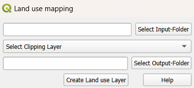
Input Requirements:
Provide a folder containing all relevant ATKIS layers (e.g.,
veg01_f,sie01_f, etc.)Processing:
Plugin automatically detects and merges necessary files into a single land use layer
Optional: Specify a clipping layer to limit the spatial extent
Maps the ATKIS land use types to Talsim-compatible categories using the fields “OBJART_TXT”, “FKT”, and “VEG”. Find the complete ATKIS to Talsim mapping table here.
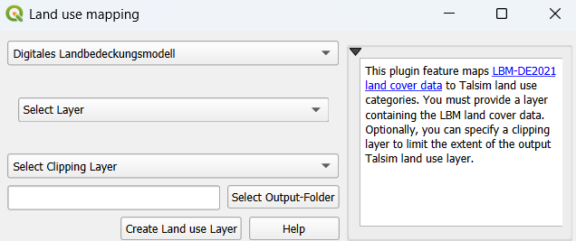
LBM-DE (2021) Data
Input Requirements:
Download data from the link above and add the layer to your current QGIS project
Processing:
Specify the layer containing LBM data
Optional: Apply a clipping layer to limit the input extent
Mapping uses fields “LB_AKT” (land cover type) and “SIE_AKT” (imperviousness). Find the complete LBM to Talsim mapping table here.
ESA World Cover Data
Input Requirements: You can use the ESA WorldCover dataset in one of the following ways: - Download the data using the QGIS plugin by specifying a layer that defines the area of interest (AOI), or - Download the ESA WorldCover dataset manually from the link above and add the raster layer to your current QGIS project.
Processing:
Choose whether to:
download the ESA WorldCover data using the QGIS plugin, or
use an existing ESA WorldCover layer from the current QGIS project.
If downloading the data, specify the layer defining the area of interest. If using an existing dataset, select the corresponding ESA WorldCover layer.
(Optional) Enable Resampling and specify the target spatial resolution (in meters) to reduce the raster resolution.
Apply a clipping layer to restrict the dataset to the desired extent.
The land cover mapping is based on the
classattribute, which stores the ESA WorldCover land cover class codes.

Output Results
The output is a GeoPackage containing two land use layers:
One layer with all land use polygons, where the mapped Talsim land use type is stored in the column “OBJART_NEU”.
A second, dissolved layer where polygons with the same land use type are aggregated. This layer can be used as input for the HRU Calculation.